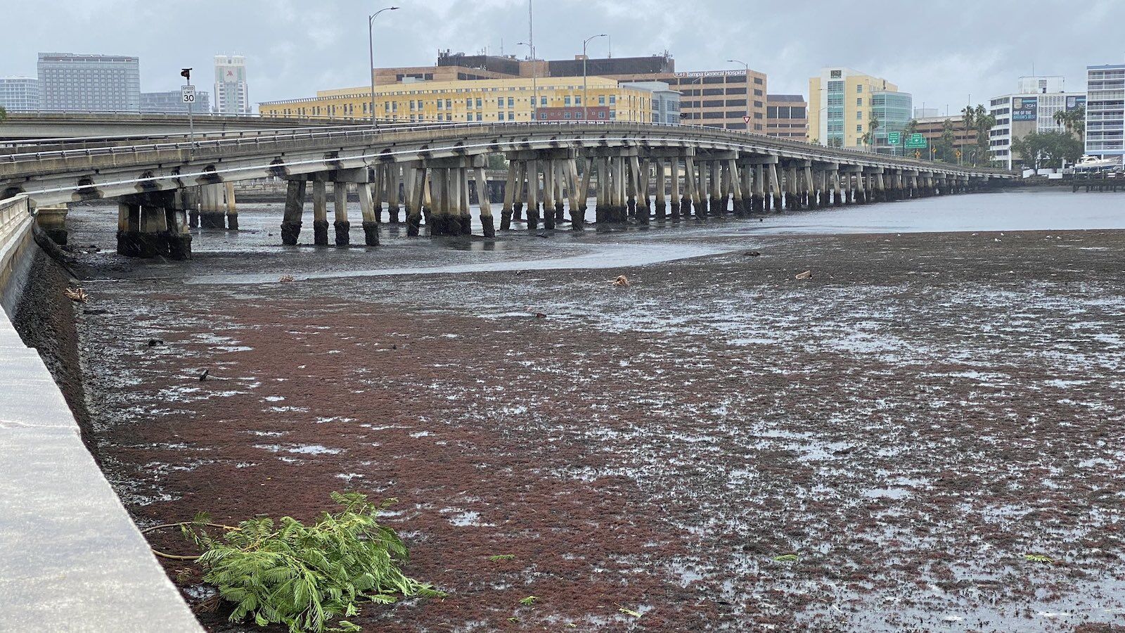
Hurricane Ian has made its way to Florida, and this Category 4 storm is projected to make its way up to North Carolina by Friday, according to the National Hurricane Center. While strong winds and floods get much of the attention during hurricanes, large bodies of water also appear to be sucked bone dry. A woman with the TikTok account @OhNoItsCo posted a video of Tampa Bay looking more like a dried-up reservoir than the massive body of water it usually is.
@ohnoitsco It’s quite literally one of the most ominous things ever #hurricaneian #tampahurricane ♬ original sound – OhNoItsCo
The video is a prime example of a weather phenomenon called negative (or reverse) storm surge. In a regular storm surge high-speed winds push the ocean water onshore, but in negative storm surge, the winds cause the bay to drain. While it might be tempting to catch out an entirely drained bay, officials are warning residents that heading toward the bay is dangerous. The water returns quickly in the span of hours, making it extremely hazardous.
STOP: Do not walk out into receding water in Tampa Bay or Charlotte Harbor – the water WILL return through storm surge and poses a life-threatening risk.
— FL Division of Emergency Management (@FLSERT) September 28, 2022
The water actually returns more present than before, with flooding of four to six feet expected in the Tampa Bay area. ![]()
